Just follow the dog shit.
Or were they llamas’?
The path to Garganta del Diablo was not well-marked, but animal wastes littered the well-trodden path. It is impossible to get lost.
Cacti and a sprawl of hardy sagebrush blanketed the wide plain as I climbed under the relentless sun.
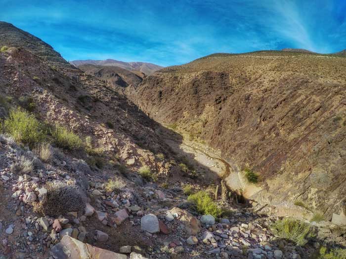
The heat and the thin mountain air form a potent recipe for panting easily. Each time I felt my energy dipped, I turned around to look at the gorgeous colourful mountains of the Quebrada de Humahuaca and I instantly felt rejuvenated.
Such is the awe of the magnificent valley of the UNESCO declared Quebrada de Humahuaca in the North of Argentina. And what I was doing was starting a roughly 7km hike from the small mountain town of Tilcara.
The Touristic Mountain Town of Tilcara
At 2465 meters above sea level, Tilcara is the touristic centre of the Quebrada de Humahuaca (or Humahuaca Ravine). I had a throbbing headache the moment I stepped off the bus – effects of the high altitude.
Tilcara reminds me of the olden day Sicily in the movie The Godfather: old stone houses built on the slopes in the mountains. The main street was paved but not on the outer edges. A dust cloud whirls when the wind blows, or when a vehicle passes by.
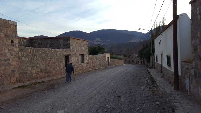
But on the main street, all hints of a time-stuck mountain town vanished as you are greeted by the lines of cafes and restaurants, hostels and colourful souvenir shops. A small bus terminal offers multiple services a day to the nearby towns of Purmarmaca and Humahuaca. Street vendors selling tortilla bread calls out to you as you walk past them.
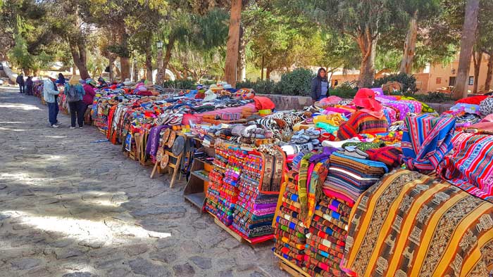
Modern day Tilcara depends on tourism for survival. Yet this is an area rich in history, with human habitation dating back to more than 10000 years.
The Fortress of Pucará de Tilcara
On a small hill 20 min from the town lies a pre-Inca fortified settlement called the Pucará de Tilcara. In the Quechua language, ‘Pucará’ means fort and as the name suggests, the site was strategically chosen to be easily defensible as it overlooks the Rio Grande de Jujuy river and a long stretch of the Quebrada de Humahuaca.
Pucará de Tilcara was a settlement of small square stone houses with low doorways and no windows, built by the Omaguaca tribe, between the first millennium A.D and the 16th century. At its peak, it housed 2000 inhabitants.
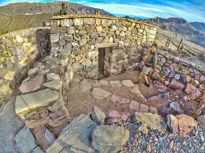
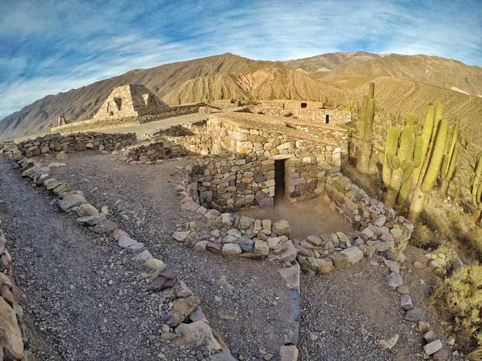
Even back then, social status determined the size and geographical layout of the buildings. Besides housing units, there was a church for religious ceremonies and a few burial sites – built from holes dug in the earth and lined with stones.
Flanked by cacti of all sizes, these stone wall buildings form a maze as I walked through them. Most were destroyed, but a handful (around 60) have been restored for modern day visitors. Now, the Pucará is the only publicly accessible archaeological site in the Quebrada de Humahuaca.
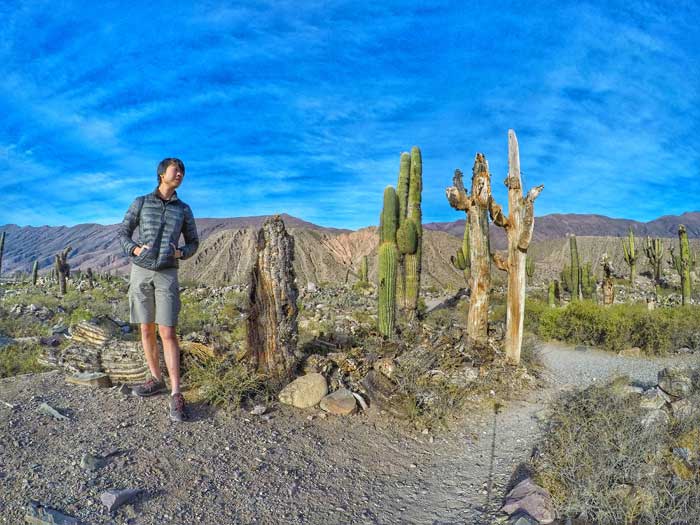
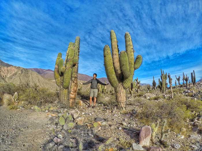
As you walk through the settlement to the summit of the gentle hill, you’ll come to the icon of this site: a huge Mesoamerican truncated pyramid. On first look, the pyramid retains the brown, stone-age architectural style of the town. But in actuality, this monument was built in 1935 to honour the first archaeologists who worked on the site. It has no connection to the ancient tribes that lived here.
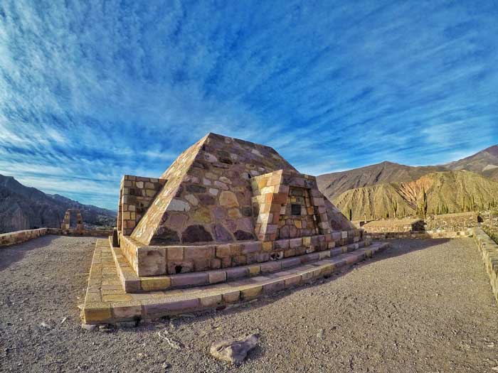
Talk about an anti-climactic hike! Even worse, construction of this 20th century monument necessitated the destruction of some of the pre-Hispanic ruins. Oh, the irony from archaeologists!
A stable of llama at the entrance and a botanical garden of different cacti colonies contribute life to the harsh scenery of Tilcara. In the distance, the mountains of the Humahuaca valley add colours, which change according to the position of the sun.
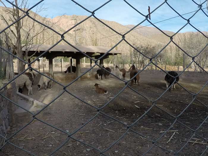
Llamassss
In the late 15th century, the Incas from the North came, saw and conquered the Quebrada tribes and took over the Pucará, until the arrival of the Spanish in 1536. It was only re-discovered in 1908 and nowadays, most visitors are archaeologists, anthropologists and scientists who are drawn by the historical mysteries locked in the Pucará.
Entrance price: ARS $200 (June 2017) with entry to the archaeology museum in Tilcara.
The Unimpressive Garganta del Diablo and Waterfall
Talking about mysteries, on the other side of the bridge is a 7km hike to the Devil’s Throat (Garganta del Diablo). With the same name as the highlight of the majestic Iguazu Falls, I couldn’t resist visiting, knowing there’s a waterfall waiting for me.
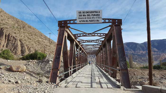
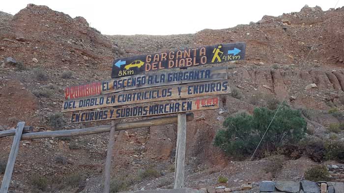
As I followed the animal wastes and overcame the first section of the hike, the track flattens out. A juxtaposition of desert scenery and the sound of a low running stream accompanied me for 50 minutes, until I came to the ticket counter.
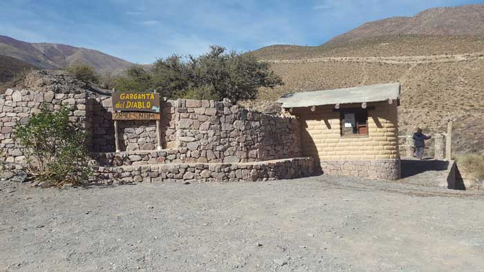
The ticket counter
An elderly dark-skinned woman gave me a ticket and a brochure in exchange for ARS $20 (June 2017). Apparently, the Devil’s Throat is owned by the aboriginal community in the area.
I signed in at the book registry at 11:30am and was the first name of the day. Sigh, low-season travels.
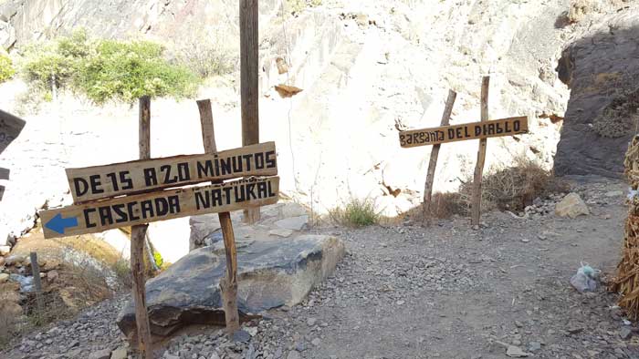
5 min down a set of stairs, two signs pointed in each direction: a natural waterfall to the left, and the Garganta del Diablo to the right. I’ll leave the best for the last, I thought, and went right.
I walked through a huge canyon to the end of the metal trail only to be blocked at the end. What?! Where is the Devil’s Throat?!
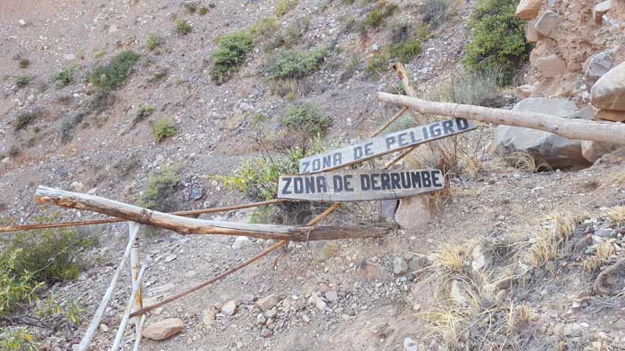
End of road
Then I realized:
The canyon that I just walked past IS the throat of the Devil. The jagged shape of the canyon – wide turning narrow, spacious turning constricting – is similar to the shape of the throat. How dare they give it the same name as the majestic falls at Iguazu?!
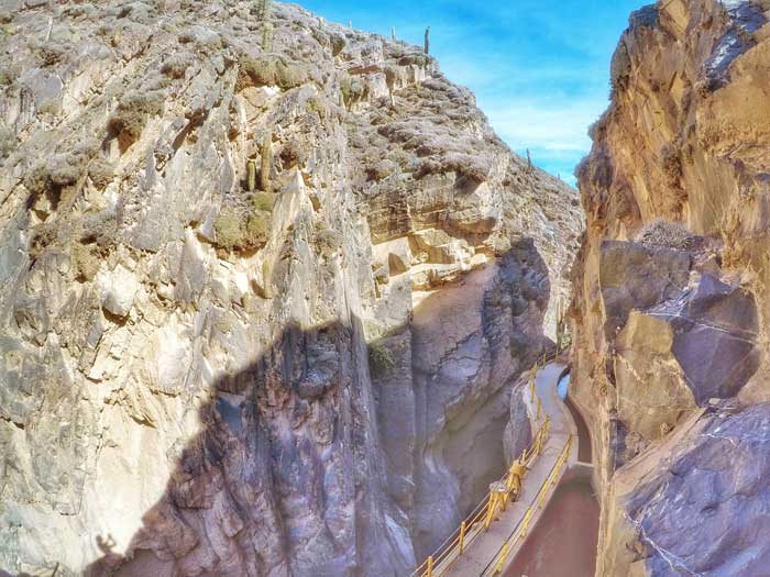
The canyon that is the Devil's Throat.
To have walked past without realizing shows just how unimpressive it is. Disappointing, but at least I have a waterfall to look forward to.
I turned back and walked towards the end of the 20min trail, stepping on small boulders and jumping over the stream, with tall brown canyons surrounding me on both sides.
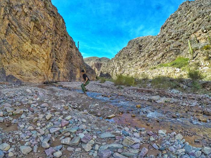
Jumping around
It’s been a while since I’ve been in the great wild outdoors. Being able to run and jump again almost three months after injuring my knee feels so damn awesome, like a bird spreading its wing, free in the sky.
Advertised as a ‘cascada natural’ or natural waterfall, it is honestly unimpressive as well. Nevertheless, any waterfall is a consolation to the disappointment that is the Devil’s Throat. I stayed there and simply enjoyed and appreciated the sound of the water crashing onto the rocks.
It is unbarricaded and the stream beneath is low, inviting me to get up close. I imagined myself meditating under the cold, rushing water. Except I wasn’t directly under, and I wasn’t meditating.
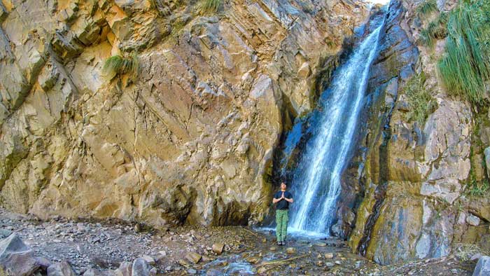
The downhill path back to town is easy. The mountains directly in front look as if it was painted with distinct strokes of green, brown, orange and yellow. I literally gasped “Oh my God” when I raised my head, even though I knew it had been there all along. Walking towards such a beautiful view, unlike walking towards a beautiful girl, is easy. I reached the trailhead in half the time I took to ascend.
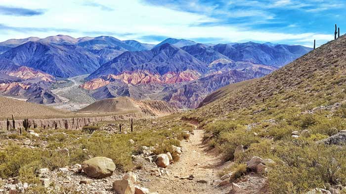
The view as I walked back to town
The town of Tilcara is a good base for visiting the region. As a tourist town, it has good infrastructures, although being in the mountains mean that WIFI is bad. But who needs WIFI when you are surrounded by such amazing views?
To the north is the town of Humahuaca, the namesake of the valley, and 30min to the south is the town of Purmarmaca, home to the Hill of the 7 Colours, and where I’m heading to next.
I stayed in Villa Nanin, a home-turned-hostel owned by an English-speaking couple from Buenos Aires. Although not as well-marked in town like other more commercial hostels, they gave great suggestions and tips and the service is top notch. Oh, and their 3-year-old son is so damn adorable. When I looked at him, I got reminded of my niece. I had breakfast with the family and felt like a part of them. Check them out here.
Since you’re in the Andes, why not try some Andean potatoes and llama meat?
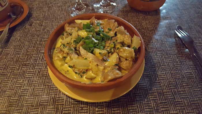
Llamaaaaa meat
And now, it’s your turn.


