The background sound muffled. My head became heavier. I squeezed my nose and blew.
POP.
The pressure escaped through my ears and the sound became clear again.
In that 45min drive from the Chilean border in San Pedro de Atacama to the Bolivian border at Hito Cajon (4480m), we gradually gained 2000m in elevation.
Welcome to the Bolivian Altiplano.
July 2017, winter. The ‘border’ is a wooden shack in the middle of the snow-filled mountains. It was freezing and all hygiene practices went out the window: I was eating with my dirty gloves on. The hot coca tea was a warm, temporary pleasure.
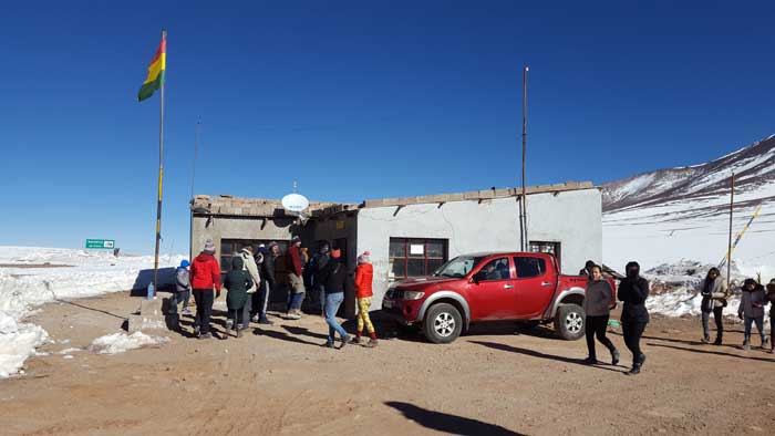
the border
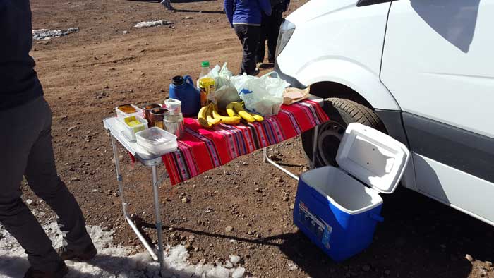
breakfast at border
Getting the entry stamp into Bolivia was a smooth process as I already got my visa in advance (and saved USD $50).
Two Chileans, a Hong Kong lady, a Polish, and a Russian were to be my groupmates for the next 3 days. Our driver, Milton, loaded our bags onto his 4x4 Toyota Land Cruiser and whisked us off towards our Bolivian adventure.
Speaking about 4x4s, we weren’t the only ones. There’s at least 20 other groups doing the same 3-days 2-nights' San Pedro – Uyuni Tour. We all switched from our minibuses from Chile to our Toyota Land Cruisers and leave at the same time. It’s gonna be a hard time finding our 4x4; almost all looked identical.
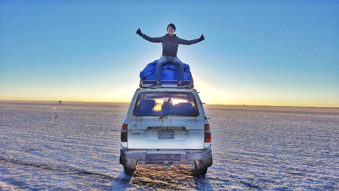
Day 1: Lakes, Lakes and more Lakes
Before heading anywhere, the Bolivians made sure that we paid the 150 Bolivianos (USD $22) park entry fee for the Eduardo Avaroa Andean Fauna National Reserve. This huge reserve is the home to all the beautiful natural sights we would see on the first day.
National Park Entrance Fee: BOB $150
Our first stop was Laguna Blanca, the White Lake (4500m) – white due to the mineral Borax. At -20 degrees’ Celsius, it was entirely frozen. We had fun taking photos walking, slipping and sitting on ice.
Furthermore, the reflections of the surrounding snow-capped mountains were a sight to behold. My very first natural attraction in Bolivia had me gone “wow”.
Off to a good start.
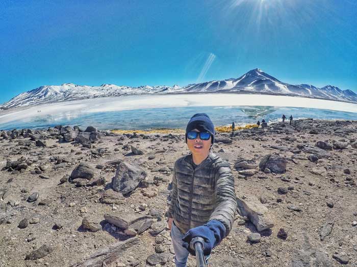
laguna blanca
Next up was Laguna Verde, the Green Lake (4400m) – green due to arsenic, lead, copper and other minerals suspended in the water.
The frozen green lake looks similar to the previous lake we visited, but it also offered an impressive reflection of the dominating Licancabur volcano, which sits between Chile and Bolivia.
At 5868m tall, this volcano is part of many legends of the Atacameno people. The surrounding smaller mountains had white snow paths that from a distance, looked like veins on the palm.
It wasn’t long before we arrived at the hot springs ‘Aguas Termals de Polques’. The heat of these pools was a warm welcome in the freezing winter, but only a few brave souls stripped and entered. I wasn’t one of them.
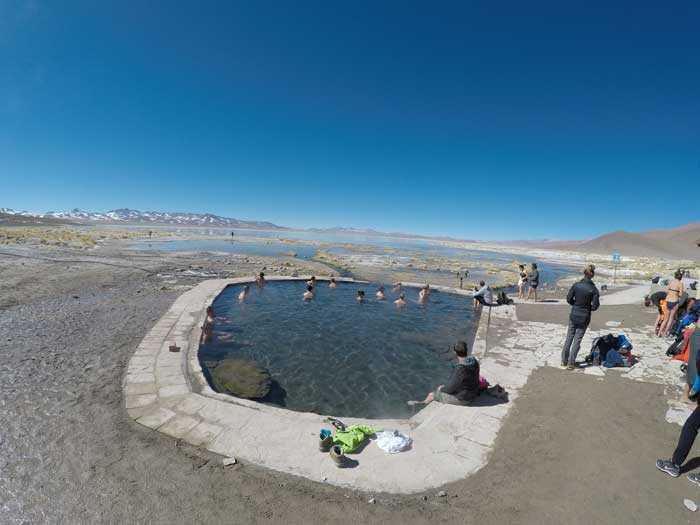
Instead, I appreciated the surrounding view of the low red mountains, dry yellow bushes and what else, a lake.
This was also the only place with toilets, and at BOB $6, was expensive for a glorified hole in the ground with no seat, no flush and no water to wash your hands.
We had our first lunch in Bolivia here and realized that every tour agency provided different food. The table next to us had pasta and meat, while we had mashed potatoes and hot dog. Coca-cola felt like a luxury here even though we JUST left Chile.
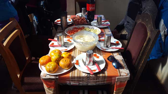
lunch
With a food coma, we drove through the bumpy desert. I felt that it was impossible to drive here without a guide. There was no paved road, just 2 lines of over-beaten tyre treks in the vast desert. At times, 2 lines of jagged ice provided a ‘path’, like audiences standing along a red carpet.
After falling asleep and waking up a few times, we reached the Sol de Mañana geyser. If you did not go to the Tatio Geysers at San Pedro de Atacama (like me), the white fuming smoke, loud hissing noise and small grey boiling pools are a welcome sight.
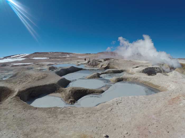
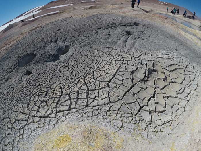
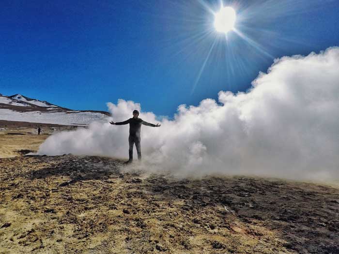
Heck, even those that went to the Tatio Geysers preferred this because you get to be more up close, and smell the strong stench of sulphur, which to me, smelt like eggs.
The final stop for the first day was what my group mates all looked forward to – Laguna Colorada (4278m), the Red Lake. The blood-red colour is a result of algae and sediments, Milton said.
On the far end of the lake are tiny white floating islets and home to many flamingos. The contrast of red and white, and the perfect reflection of the jagged mountain standing in the middle of the lake, presented an unbelievably photogenic scene.
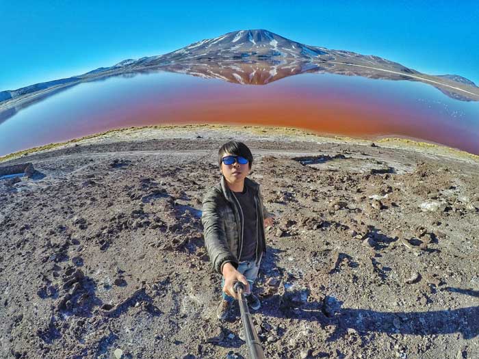
No wonder this lake is the crowd’s favourite.
Near to Laguna Colorada is our very basic hostel for the night. There was no shower, and electricity was only available from 6:10pm till 9pm when we frantically charged our cameras.
After dinner, all the groups from different agencies gathered around the only heater in the lodge, exchanging stories and languages and shared a laugh. We were given one minute’s warning before light was cut off. That night, the temperature fell to -14 degrees, and I wrapped myself up like a mummy.
Day 2: Long Day on the Road
We left as the sun rose and headed to one of the driest places in the world – the Siloli Desert. The most outstanding feature is the Arbol de Piedra (Stone Tree), a rocky formation naturally sculpted by wind and water to look like a tree.
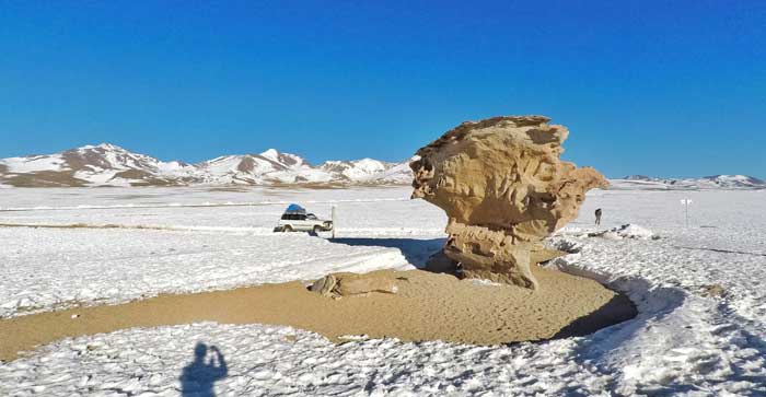
It looked extremely underwhelming given all the hype in the tour photos. I was more interested in kicking the ice and snow which blanketed the desert, and climbing the surrounding rocks.
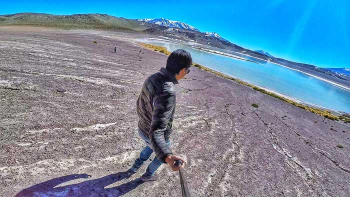
I was warned that Day 2 is a lot of driving and true enough, after a long bumpy drive through snow and sand, we reached another frozen lake: Laguna Honda.
I was amazed that the lake could remain completely frozen despite the sun shining directly on it. I could even see the white sparkling sunlight bouncing off the frozen surface of the lake.
“Internet, wifi?” asked the Chilean girl in our group as we parked next to Los Flamencos Eco Hotel at our next stop. I realized she was talking about the sign by the hotel. There was a restaurant, toilet and wifi, but all required payment. Ha, nice try. Who needs wifi in nature?
Right by the hotel is the smelly lake, Laguna Hedionda (4121 m). It smelled because it is home to hundreds of white and pink feeding flamingos. This is also the nearest to flamingos you can get (for a photo) throughout the whole trip.
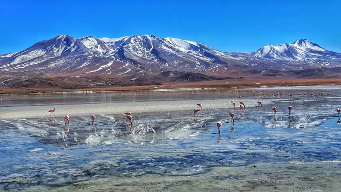
The next stop is the relatively smaller Laguna Negra, the Black Lake, and just like Laguna Honda, was sparkling under the shining sun, even though it was covered with algae. By this time, I was tired of seeing lakes. We spent only a few minutes at each. It felt like our driver brought us to each place just to tick off his to-do list.
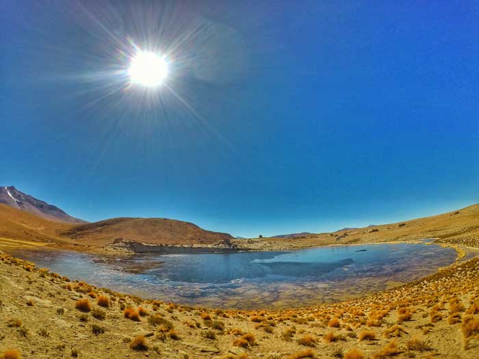
Another long drive passing by deserts and canyons and rock formations (akin to Ischigualasto) before reaching a small town for lunch. It didn’t help that Milton, our driver, had a bad sense of time. To him, 10 minutes = 30 minutes and 1.5 hours = 2.5 hours. Each time we asked him how long to the next stop, we made a mental note to multiply it by Milton’s Factor.
Our final stop was a small town with an abandoned train carriage and an empty basketball court. The railway track runs from Uyuni in Bolivia to Calama in Chile. Milton mentioned that there were only 10 people living in that town in the off-season. Why did he even bring us here?
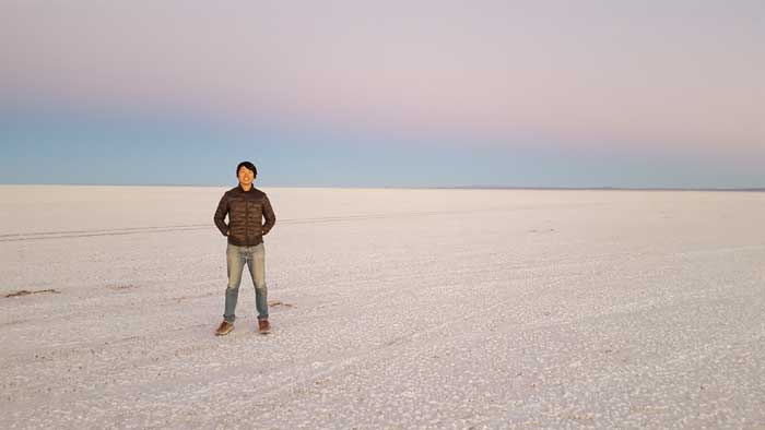
We checked in to our Salt Hostel right next to the salt flat and rushed for the sunset. I was overcame with emotions as I stepped off the jeep onto the salt flat, and I told myself “I made it!”
The Salar de Uyuni is often a backpacker's Top 10 Destinations in South America and it was a surreal feeling as I stepped onto it the first time.
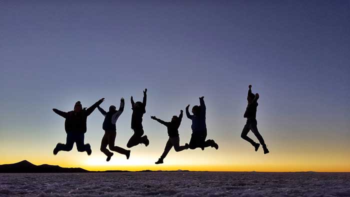
The sunset, like at the moon valley at San Pedro, was a gorgeous shade of blue, purple and pink. Most people woke up early for the sunrise, but not many made it for the sunset at the Uyuni salt flats. It was the perfect opportunity for silhouette shots.
The Salt Hostel is a building made entirely of salt: the walls, the floors, the beds. About the only thing that is not made of salt is the decorations. This is also the only opportunity for a shower on this tour with the infamous ‘5 min, BOB $10’ rule. The 5-min rule is true but interestingly enough, the grumpy old man did not charge us for a shower.
Day 3: The Grand Finale at Salar de Uyuni
Staying right at the edge of the famous salt flats means we could have breakfast and still make it for sunrise. We did, and it was so freezing cold that my fingers hurt. The photos just have to wait for a later timing.
We drove to Inkahuasi (Inca House), a rocky island full of cacti. If you pay BOB $30, you can hike up to the top and be greeted with a 360 degrees view of the majestic white salt flats (and get battered by the strong winds).
Many groups drove here early, hiked up for the sun rise, and ended up having their breakfast by the salt tables.
Milton explained that Inkahuasi was one of 14 islands here before the eruption of a volcano and when the salt flat was still a giant lake, some 40 000 years ago. Now, it is submerged and only the top is left to explore. It covers just 61 acres out of the almost 11000 square kilometres of the salt flats.
Yes, the Uyuni Salt Flats (Salar de Uyuni) is more than 10 times bigger than Singapore and when we drove, the horizon seemed never ending from all directions.
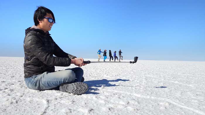
When we finally stopped in the middle of nowhere, it was to take the famous perspective photos, The grand scale and almost perfectly flat landscape - there aren’t hills or bumps or lakes or shadows – means a lack of visual reference points making it easy to skew one’s perspective.
In the rainy season, the salt flat has another name: Sky Mirror. When filled with water, it is able to give the most perfect reflection photos. Sadly, it wasn’t the right season for me.
I am truly thankful for the experienced Milton for guiding and laying on his stomach to take the photos. It was the most fun moment of the tour.
Before coming to Uyuni, I was looking forward to our next stop – the area outside the Salt Hotel with flags from different countries.
I saw a post from a Singaporean lamenting the fact that there isn’t a Singapore flag, and I also asked Milton if he ever saw one. He said no and my hopes were up because I brought one just for this.
True enough, when we arrived, my group and I walked around without seeing a Singapore flag. I tied the flag and proudly planted it with the help of Milton. I swelled with pride and joy.
Update: A friend I met in Chile told me he planted one in May when he saw my video (it could’ve flown away or maybe got hidden), which means I'm not the first.
Update 2: A Singaporean friend went a few weeks after me and only saw my flag (and signed it too). Made my day.
The Colchani Artisanal Fair is a touristic market near the salt flats lined with colourful souvenir stalls. I had my first taste of llama meat and beer with coca leaves. $2 for a beer, I love Bolivia already.
Before ending our tour at Uyuni, we headed to the Train Cemetery, a junkyard of abandoned trains. The train lines were built to connect Bolivia and Chile and used mainly for mining purposes, but were frequently sabotaged by the indigenous people, and left to rust after the mining industry collapsed.
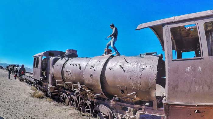
Today, local kids climb them like it’s their playground, and I joined them. For a moment, I felt like James Bond.
This was an amazing introduction to Bolivia – one of my favourite countries so far. Gorgeous lakes, incredible salt flats and one hell of an international adventure.
Points to Note:
- There are MANY tour agencies in San Pedro and Uyuni providing this tour and the opposite route.
- Shop around, read reviews online, talk to people before deciding.
- All tours follow mainly the same route, and the only things that differ is the quality and quantity of food, quality of driver and accommodation.
- Most drivers from the Bolivia side do not speak English.
- Food is included (breakfast, lunch and dinner) but do bring your own snacks as well.
- We were recommended to bring a huge 6L water bottle each, but none of us drank all.
- Electricity is limited and there is NO INTERNET.
- The tour costs between CLP $90 000 and CLP $130 000.
- Expect to be picked up early around 7am for the border crossing, which can take a while since all tour buses will be there at the same time.
- Prepare some poses for your salt flat photos!
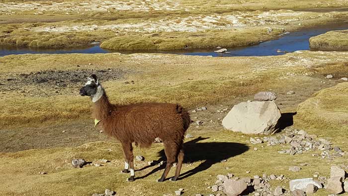
here's a llama for you
And now, it’s your turn.

